9.3.1.1 Plate Tectonics
Compare and contrast the interaction of tectonic plates at convergent and divergent boundaries.
For example: Compare the kinds of magma that emerge at plate boundaries.
Use modern earthquake data to explain how seismic activity is evidence for the process of subduction.
For example: Correlate data on distribution, depth and magnitude of earthquakes with subduction zones.
Describe how the pattern of magnetic reversals and rock ages on both sides of a mid-ocean ridge provides evidence of sea-floor spreading.
Explain how the rock record provides evidence for plate movement.
For example: Similarities found in fossils, certain types of rocks, or patterns of rock layers in various locations.
Describe how experimental and observational evidence led to the theory of plate tectonics.
Overview
MN Standard in Lay Terms
The earth's lithosphere is made up of large segments or plates that move relative to each other. New lithosphere is continuously created at mid-ocean spreading centers (divergent boundaries). Since the earth is constant in its size, there is an equal loss of surface material elsewhere on the planet at subduction zones (convergent boundaries). In some places, the plates slide past each other (transform boundaries). Each type of boundary is characterized by geologic activity such as earthquakes volcanoes, and mountain building.
Big Idea
Earth Science Literacy: The Big Ideas and Supporting Concepts of Earth Science.:
(9.3.1.1.1)
4.3 Earth's interior is in constant motion through the process of convection, with important consequences for the surface.
4.4 Earth's tectonic plates consist of the rocky crust and uppermost mantle, and move slowly with respect to one another.
4.5 Many active geologic processes occur at plate boundaries.
(9.3.1.1.2)
1.4 Earth scientists must use indirect methods to examine and understand the structure, composition, and dynamics of Earth's interior.
(9.3.1.1.3)
1.4 Earth scientists must use indirect methods to examine and understand the structure, composition, and dynamics of Earth's interior.
2.1 Earth's rocks and other materials provide a record of its history.
(9.3.1.1.4)
2.1 Earth's rocks and other materials provide a record of its history.
(9.3.1.1.5)
1.6 Earth scientists construct models of Earth and its processes that best explain the available geological evidence.
1.7 Technological advances, breakthroughs in interpretation, and new observations continuously refine our understanding of Earth.
MN Standard Benchmarks
9.3.1.1.1 Compare and contrast the interaction of tectonic plates at convergent and divergent boundaries.
9.3.1.1.2 Use modern earthquake data to explain how seismic activity is evidence for the process of subduction.
9.3.1.1.3 Describe how the pattern of magnetic reversals and rock ages on both sides of a mid-ocean ridge provides evidence of sea-floor spreading.
9.3.1.1.4 Explain how the rock record provides evidence for plate movement.
9.3.1.1.5 Describe how experimental and observational evidence led to the theory of plate tectonics.
The Essentials
A cartoon short that will play before Ice Age: Continental Drift, featuring Scrat.
Content Standard A:
(9.3.1.1.5)
Scientific explanations must adhere to criteria such as: a proposed explanation must be logically consistent; it must abide by the rules of evidence; it must be open to questions and possible modification; and it must be based on historical and current scientific knowledge. page 176
Content Standard C
(9.3.1.1.2)
Waves, including sound and seismic waves, waves on water, and light waves, have energ and can transfer energy when they interact with matter. page 180
Content Standard D:
(9.3.1.1.1)
Lithospheric plates on the scales of continents and oceans constantly move at rates of centimeters per year in response to movements in the mantle. Major geological events, such as earthquakes, volcanic eruptions, and mountain building, result from these plate motions. page 160 (5-8 standard)
(9.3.1.1.4)
Geologic time can be estimated by observing rock sequences and using fossils to correlate the sequences at various locations. Current methods include using the known decay rates of radioactive isotopes present in rocks to measure the time since the rock was formed. page 189
Content Standard G History and Nature of Science:
(9.3.1.1.5)
Occasionally, there are advances in science and technology that have important and long-lasting effects on science and society. Examples of such advances include the following......Plate Tectonics page 204
Volume 1
Cluster: Processes That Shape the Earth
Maps: Changes in the Earth's Surface (CS) pp. 50-51
Plate Tectonics (PT) pp. 52-53
Cluster: Scientific Inquiry
Scientific Investigations (SI) pp.18-19
Scientific Theories (ST) pp. 20-21
Volume 2
Cluster: Historical Perspectives
Map: Moving the Continents (10DE) pp. 78-79
Cluster: The Nature of Science
Map: . Scientific World View(1A) pp. 4-5
Benchmarks of Science Literacy (2009)
Many of the issues in the development of the Theory of Plate Tectonics are found in The Nature of Science, Scientific World View and Scientific Inquiry
(9.3.1.1.1, 9.3.1.1.2)
There are worldwide patterns to major geological events (such as earthquakes, volcanic eruptions, and mountain building) that coincide with plate boundaries. 4C/M13
Earthquakes often occur along the boundaries between colliding plates, and molten rock from below creates pressure that is released by volcanic eruptions, helping to build up mountains. Under the ocean basins, molten rock may well up between separating plates to create new ocean floor. Volcanic activity along the ocean floor may form undersea mountains, which can thrust above the ocean's surface to become islands. 4C/H5
(9.3.1.1.5)
Matching coastlines and similarities in rock types and life forms suggest that today's continents are separated parts of what was long ago a single continent. 4C/M9
As soon as fairly accurate world maps began to appear, some people noticed that the continents of Africa and South America looked as though they might fit together, like a giant jigsaw puzzle. This led some to speculate that they might have once been part of a single giant land mass that broke into pieces and then drifted apart. This idea was repeatedly suggested and rejected because it was hard to imagine that anything that large and apparently immobile could move. 10E/H1*
Early in the 1900s, Alfred Wegener, a German scientist, reintroduced the idea of moving continents, adding such evidence as the underwater shapes of the continents, the similarity of life forms and land forms in corresponding parts of Africa and South America, and the increasing separation of Greenland and Europe. Even with this evidence and the realization that the earth was old enough for this to have occurred, very few contemporary scientists adopted Wegener's theory because he lacked a plausible mechanism for the movement of continents. 10E/H2*
In the 1960s, scientists noted that earthquakes occur much more frequently in certain areas, that the rock around mid-ocean ridges is progressively older the farther it is from the ridge, and that this gradient is symmetrical on either side of the ridge. This evidence, coupled with a scientifically sound physical explanation for how continents could move, transformed the idea of moving continents into the theory of plate tectonics. 10E/H3*
Scientists continue to study the motions of the earth's plates and the phenomena those motions cause in an attempt to better understand the internal composition of the earth and the processes taking place within it. 10E/H4**
National Assessment of Educational Progress (NAEP)
(9.3.1.1.1)
E8.9: Lithospheric plates on the scale of continents and oceans constantly move at rates of centimeters per year in response to movements in the mantle. Major geological events, such as earthquakes, volcanic eruptions, and mountain building, result from these plate motions
E12.8: Mapping of the Mid-Atlantic Ridge, evidence of sea floor spreading, and subduction provided crucial evidence in support of the theory of plate tectonics. The theory currently explains plate motion as follows: the outward transfer of Earth's internal heat propels the plates comprising Earth's surface across the face of the globe. Plates are pushed apart where magma rises to form midocean ridges, and the edges of plates are pulled back down where Earth materials sink into the crust at deep trenches.
(9.3.1.1.3)
E8.10: Earth as a whole has a magnetic field that is detectable at the surface with a compass. Earth's magnetic field is similar to the field of a natural or manmade magnet with north and south poles and lines of force. For thousands of years, people have used compasses to aid in navigation on land and sea.
(9.3.1.1.4)
E8.4: Earth processes seen today, such as erosion and mountain building, make it possible to measure geologic time through methods such as observing rock sequences and using fossils to correlate the sequences at various locations.
(9.3.1.1.5)
E12.8: Mapping of the Mid-Atlantic Ridge, evidence of sea floor spreading, and subduction provided crucial evidence in support of the theory of plate tectonics. The theory currently explains plate motion as follows: the outward transfer of Earth's internal heat propels the plates comprising Earth's surface across the face of the globe. Plates are pushed apart where magma rises to form midocean ridges, and the edges of plates are pulled back down where Earth materials sink into the crust at deep trenches.
Common Core Standards
Math. Many of the activities involve the Standards for Mathematical Practice:
1. Make sense of problems and persevere in solving them.
2. Reason abstractly and quantitatively.
3. Construct viable arguments and critique the reasoning of others.
4. Model with mathematics.
5. Use appropriate tools strategically.
6. Attend to precision.
7. Look for and make use of structure.
8. Look for and express regularity in repeated reasoning.
English Language Arts: Assigned reading and written reports should be guided by the Literacy in History/Social Studies, Science, and Technical Subjects Standards
Reading Standards for Literacy in History/Social Studies 6-12
Key Ideas and Details
1. Read closely to determine what the text says explicitly and to make logical inferences from it; cite specific textual evidence when writing or speaking to support conclusions drawn from the text.
2. Determine central ideas or themes of a text and analyze their development; summarize the key supporting details and ideas.
3. Analyze how and why individuals, events, or ideas develop and interact over the course of a text.
Craft and Structure
4. Interpret words and phrases as they are used in a text, including determining technical, connotative, and figurative meanings, and analyze how specific word choices shape meaning or tone.
5. Analyze the structure of texts, including how specific sentences, paragraphs, and larger portions of the text (e.g., a section, chapter, scene, or stanza) relate to each other and the whole.
6. Assess how point of view or purpose shapes the content and style of a text.
Integration of Knowledge and Ideas
7. Integrate and evaluate content presented in diverse formats and media, including visually and quantitatively, as well as in words.*
8. Delineate and evaluate the argument and specific claims in a text, including the validity of the reasoning as well as the relevance and sufficiency of the evidence.
9. Analyze how two or more texts address similar themes or topics in order to build knowledge or to compare the approaches the authors take.
Range of Reading and Level of Text Complexity
10. Read and comprehend complex literary and informational texts independently and proficiently.
Writing Standards for Literacy in History/Social Studies, Science, and Technical Subjects 6-12
Text Types and Purposes*
1. Write arguments to support claims in an analysis of substantive topics or texts using valid reasoning and relevant and sufficient evidence.
2. Write informative/explanatory texts to examine and convey complex ideas and information clearly and accurately through the effective selection, organization, and analysis of content.
3. Write narratives to develop real or imagined experiences or events using effective technique, well-chosen details and well-structured event sequences.
Production and Distribution of Writing
4. Produce clear and coherent writing in which the development, organization, and style are appropriate to task, purpose, and audience.
5. Develop and strengthen writing as needed by planning, revising, editing, rewriting, or trying a new approach.
6. Use technology, including the Internet, to produce and publish writing and to interact and collaborate with others.
Research to Build and Present Knowledge
7. Conduct short as well as more sustained research projects based on focused questions, demonstrating
understanding of the subject under investigation.
8. Gather relevant information from multiple print and digital sources, assess the credibility and accuracy of each source, and integrate the information while avoiding plagiarism.
9. Draw evidence from literary or informational texts to support analysis, reflection, and research.
Range of Writing
10. Write routinely over extended time frames (time for research, reflection, and revision) and shorter time frames (a single sitting or a day or two) for a range of tasks, purposes, and audiences.
Misconceptions
Student Misconceptions:
AAAS Project 2061 Science Assessment Website
(9.3.1.1.1)
Earth's plates are located deep within the earth and are not exposed at the earth's surface.
Earth's plates are separated by empty gaps.
Earth's plates are rigid.
Plates are pushed apart by the upwelling magma.
The edge of a continent is the same thing as a plate boundary.
A plate boundary is a sharp defined line as opposed to a zone.
(9.3.1.1.2)
The ground cracks opens during an earthquake to swallow people and buildings.
(9.3.1.1.3)
Students think of north and south in geographic terms, not magnetic. Therefore the earth "flips," not the polarity.
(9.3.1.1.5)
Students think the shape and location of continents have remained the same throughout geologic time.
Vignette
At the beginning of the unit on Earth's Dynamic Geosphere/Dynamic Earth, Mr. O. asks if there have been earthquakes in Minnesota. After the class has discussed the question, he hands out copies of Minnesota at a Glance: "Earthquakes in Minnesota" and reads the article from the September 4, 1917, Little Falls Daily Transcript. Students can use the handout as a basic primer on earthquakes.
Using the data from the handout, students plot the distribution of Minnesota earthquakes on an outline map using latitude and longitude of the epicenters. They then conduct an on-line search for earthquake data using the earthquake search page at the USGS web site to find out if more recent earthquakes in Minnesota have occurred. They can also search for newspaper accounts of the more recent earthquakes and compare those accounts to the Staples earthquake. Using the information they have assembled, the students can determine if there is a need for earthquake planning in building codes in any areas of Minnesota.
This classroom exercise provides an introduction to "Discovering Plate Boundaries." Obtain copy of Earthquakes in Minnesota from Minnesota Geological Survey. On-line search using Earthquake search USGS (recommend using rectangular area search).
Resources
Suggested Labs and Activities
(9.3.1.1.1)
"Discovering Plate Boundaries" is a classroom exercise based on four world maps containing earthquake, volcano, topography, and seafloor age data. This exercise is based on observation and classification
(9.3.1.1.2)
"Real Evidence of a Subducting Plate" The objective of this activity is to allow students to manipulate real data and understand how such data are interpreted and used in support of a theory. The concepts studied are maps, earthquakes, and the beginning of the unit on tectonics, particularly a subduction zone plate boundary.
(9.3.1.1.3)
"Magnetic patterns: ocean floor pattern plotting" Students use magnetic field data and a map of the ocean floor around Iceland to observe how the direction of magnetisation of the ocean floor varies. This links the magnetization of rocks with the theory of plate tectonics.
USGS Open File Report 99-132 (online) This report describes how to build a model of the outer 300 km (180 miles) of the earth that can be used to develop a better understanding of the principal features of plate tectonics, including sea-floor spreading, the pattern of magnetic stripes frozen into the sea floor, transform faulting, thrust faulting, subduction, and volcanism.
(9.3.1.1.4)
Wegener's Puzzling Evidence Exercise. This activity is based on Alfred Wegener's studies that demonstrated that the scattered distribution of certain fossil plants and animals on present-day, widely separated continents would form coherent patterns if the continents are rejoined as the pre-existing supercontinent Gondwanaland. Listed as a 6th grade activity, it is a good introductory activity to the history of plate tectonics.
(9.3.1.1.5)
Metzger, E.P. (n.d.). A model of sea-floor spreading.
The activity from the site is a good one for learning about seafloor spreading, and it discusses how this served as evidence for the mechanism of plate movement. Instructor facilitation could be used in conjunction with this activity to help students develop an explanation for how "experimental" and "observational" evidence led to the theory of plate tectonics.
USGS. (1999). Developing the theory [of Plate Tectonics]. The site provides a background description of the ocean floor mapping activities used to identify magnetic reversals that led to an understanding of spreading centers as they relate to plate tectonics. The resource is suitable for providing teachers with information as well as students who might be conducting research about the topic.
Instructional Suggestions/options
As exemplified in the vignette, consider having students plot the location of earthquakes on a Minnesota map and researching on the USGS Recent Earthquake web page to identify more recent Minnesota earthquakes to plot on their maps. Consider incorporating other hands-on activities, such as: Wegener's puzzle or the Real Evidence of a Subducting plate activity.
Additional resources
The Geology of Minnesota: A Guide for Teachers
This guide, a collaborative effort between the Division and the Minnesota Geological Survey, is a summary of Minnesota's geology. It is intended for earth science teachers grade 6-8 and others who have an interest or some background in geology. (MnDNR) Good introduction to Minnesota geology.
Earth Revealed: A video instructional series on geology for college and high school classrooms and adult learners; 26 half-hour video programs and coordinated books. This is an Annenberg Learner programs online resource, produced in 1992, covering multiple topics. Several segments deal with plate tectonics, earthquakes, volcanoes, geologic time.
Geology.com has a teacher resource link that provides links to classroom activities and resources in several earth science subject areas.
(9.3.1.1.1)
From the USGS: "This Dynamic Earth" is one of the most recommended and referenced primers on plate tectonics. Topics include a history of the theory, scientific developments that spurred its development, the mechanics of plate motions, and the relationship of hotspots to plate tectonic theory. A companion best-selling map, "This Dynamic Planet", is also available online or in print.
"Putting Earthquakes in Their Place": A group of researchers at NASA's Goddard Space Flight Center put together a Geological Information System (or GIS) series of maps of the planet's tectonic activity. The maps show plate boundaries, large fault zones, location of major volcanic eruptions, earthquake epicenters, and movement of the earth's crust.
This is the result of an Advanced Earthquake Topic Search - Learning Links that gives a variety of linked sites that provide animations, lesson plans, and demonstrations connected with earthquakes and plate tectonics.
(9.3.1.1.1, 9.3.1.1.2)
Incorporated Research Institutions for Seismology (IRIS): Animations and short videos on plate tectonics and earthquakes that can be used for teacher education and in the classroom. Several of the Quicktime movies have PowerPoint downloads available.
(9.3.1.1.3)
Describe how the pattern of magnetic reversals and rock ages on both sides of a mid-ocean ridge provides evidence of sea-floor spreading.
Nova program, "Magnetic Storm" explores what creates Earth's magnetic field and shows how scientists use ancient pottery and volcanic rock to study changes in the direction and strength of Earth's magnetic field over time. Has teacher guide and activities.
NSF funded site, Visionlearning.com, Plate Tectonics I, gives a history of the development of the theory.
SciNews provides timely, pre-packaged lessons on a science current event (such as an oil spill, earthquake, or shuttle launch) that are short (~15 min.), easy to implement, and align to AZ state standards. Each current event lesson has an associated PDF document that contains a brief overview of the event and lesson, as well as a map, photo(s), and AZ standards targeted.
Vocabulary/Glossary
Asthenosphere: The ductile part of the earth just below the lithosphere, about 180 km thick and found 100-250 km (60-150 mi) below the earth's surface. The asthenosphere yields to persistent stresses more than the rigid crust or the core.
Continental rifting: The process by which a continent stretches and splits apart; if successful, this process separates a larger continent into two smaller continents separated by an expanding ocean.
Convergence: Coming together or joining at a common point. At convergent boundaries tectonic plates are moving toward each other.
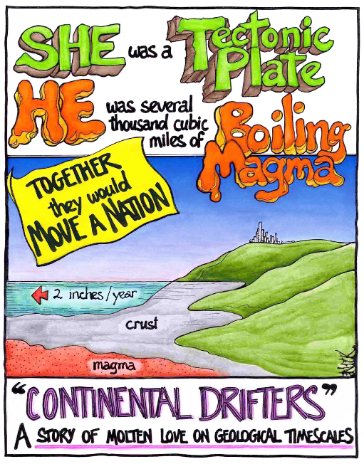
Crust: The outermost major layer of the earth, ranging from about 10 to 65 km in thickness worldwide. The uppermost 15-35 km of crust is brittle enough to produce earthquakes. Oceanic crust is thinnest; continental crust is the thickest.
Deformation: Process where rocks are folded, faulted, sheared or compressed by earth stresses.
Divergence: Moving apart from a common point. At divergent boundaries plates are moving apart.
Earthquake: Shaking or trembling of the earth that accompanies rock movements extending anywhere from the crust to 680 km below the earth's surface. It is the release of stored elastic energy caused by sudden fracture and movement of rocks inside the earth. Part of the energy released produces seismic waves, like P, S, and surface waves that travel outward in all directions from the point of initial rupture. These waves shake the ground as they pass. An earthquake is felt if the shaking is strong enough to cause ground accelerations exceeding approximately 1.0 centimeter/second squared.
Epicenter: The point on the earth's surface directly above the focus of an earthquake.
Fault: A fracture or zone of fractures in rock along which the two sides have been displaced relative to each other. If the main sense of movement on the fault plane is up (compressional; reverse) or down (extensional; normal), it is called a dip-slip fault. Where the main sense of slip is horizontal, the fault is known as a strike-slip fault. Oblique-slip faults have both strike- and dip-slip.
Focus: The point on the fault at which the first movement or break occurred. Directly beneath the epicenter at 1-50 km depth.
Lithosphere: Solid, rocky, outer part of the earth, ~100 km thick (50 miles), comprised of the crust and the solid portion of the mantle. Thickness is age dependent: older lithosphere is thicker than younger oceanic lithosphere. The lithosphere below the crust is brittle enough at some locations to produce earthquakes by faulting, such as within a subducted oceanic plate.
Magma: Molten rock material that is liquid or pasty that originated within the earth. Molten rock below the surface of the earth. Lava is molten rock on the surface of the earth.
Magnetic Reversal: A change in the earth's magnetic field between normal polarity and reversed polarity.
Magnitude: A number that characterizes the relative size of an earthquake. Magnitude is based on measurement of the maximum motion recorded by a seismograph.
Mantle: The layer in earth's interior between the crust and the metallic core.
Plate: A large, relatively rigid segment of the earth's lithosphere that moves in relation to other plates over the asthenosphere.
Plate Tectonics: The theory supported by a wide range of evidence that considers the earth's crust and upper mantle to be composed of several large, thin, relatively rigid plates that move relative to one another. Slips along faults that define the plate boundaries commonly results in earthquakes.
Seismic Wave: An elastic wave generated by an impulse such as an earthquake or an explosion. Seismic waves may travel either through the earth's interior (P and S waves; the fastest waves) or along or near the earth's surface (Rayleigh and Love waves). Seismic waves travel at speeds of several kilometers per second.
Seismogram: A real-time record of earthquake ground motion recorded by a seismograph.
Seismograms: The records (paper copy or computer image) used to calculate the location and magnitude of an earthquake.
Seismograph: An instrument that records vibrations of the earth, especially earthquakes. Seismograph generally refers to the seismometer and a recording device as a single unit.
Seismology: Science that deals with earthquakes and attendant phenomena including the study of artificially produced elastic waves in the earth's material.
Seismometer: A sensitive instrument that can detect waves emitted by even the smallest earthquakes. (See seismograph.)
Subduction: The process of the oceanic lithosphere colliding with and descending beneath the continental lithosphere.
Subduction zone: The place where two lithospheric plates come together, one riding over the other. Most volcanoes on land occur parallel to and inland from the boundary between the two plates.
Tectonics: Large-scale deformation of the outer part of the earth resulting from forces in the earth.
Tectonic plates: The large, thin, relatively rigid plates that move relative to one another on the outer surface of the earth. Comprised of the solid section of the earth's crust and outermost mantle that moves over the deeper mantle. Avoid using the term "crustal plates" since the upper mantle is also involved.
Educational Multimedia Visualization Center of the Department of Earth Science, U.C.S.B:
All materials are made available via web downloads and links and in other formats, free of charge for educators' use.
SeisMac is a Mac OS X application that turns your MacBook or MacBook Pro into a seismograph. It accesses your laptop's Sudden Motion Sensor in order to display real-time, three-axis acceleration graphs. Version 3.0 lets you select and export your collected data.
The Earth Exploration Toolbook
The Earth Exploration Toolbook is a collection of computer-based Earth Science activities. Each activity, or chapter, introduces one or more data sets and an analysis tool that enables users to explore some aspect of the earth system. Step-by-step instructions in each chapter walk users through an example - a case study in which they access data and use analysis tools to explore issues or concepts in earth system science. In the course of completing a chapter, users produce and analyze maps, graphs, images, or other data products. The ultimate goal of each activity is to build user's skills and confidence so they can use data to conduct their own investigations of the earth system.
MN Math Benchmarks
Calculate measurements of plane and solid geometric figures; know that physical measurements depend on the choice of a unit and that they are approximations.
9.3.1.3 Understand that quantities associated with physical measurements must be assigned units; apply such units correctly in expressions, equations and problem solutions that involve measurements; and convert between measurement systems.
9.3.1.5 Make reasonable estimates and judgments about the accuracy of values resulting from calculations involving measurements.
Explain the uses of data and statistical thinking to draw inferences, make predictions and justify conclusions.
9.4.2.1 Evaluate reports based on data published in the media by identifying the source of the data, the design of the study, and the way the data are analyzed and displayed. Show how graphs and data can be distorted to support different points of view. Know how to use spreadsheet tables and graphs or graphing technology to recognize and analyze distortions in data displays.
9.4.2.2 Identify and explain misleading uses of data; recognize when arguments based on data confuse correlation and causation.
9.4.2.3 Explain the impact of sampling methods, bias and the phrasing of questions asked during data collection.
Assessment
Assessment of Students
Plate tectonic theory fundamentally altered how geologists view the earth. The biggest difference in the new theory was that the earth:
(a) has a magnetic field that fluctuates.
(b) has numerous features on the ocean floor.
(c) is dynamic, constantly changing.
(d) is shrinking, like a raisin.
Which of the following statements is TRUE?
(a) New plate material is being added to the edges of plates, and no plate material is being removed.
(b) Plate material is being removed from the edges of plates, and no new plate material is being added.
(c) New plate material is being added to the edges of plates, and the same amount of plate material is being broken into pieces and carried away.
(d) New plate material is being added to the edges of plates, and the same amount of plate material is being crumpled upward or recycled back into the earth's interior.
PDF files of NY Regents Earth Science exams from 1941 onward. New York Regents Earth Science exams
On-line quizzes on key concepts are available at the website for Earth - An Introduction to Physical Geology, Tarbuck and Lutgens. Chapter 2 - Plate Tectonics, Chapter 5 - Volcanoes, Chapter 9 - Geologic Time, and Chapter 11 - Earthquakes
Assessment of Teachers
How did Wegener's hypothesis of Continental Drift evolve into the Theory of Plate Tectonics?
What is meant by the term "Dynamic Earth?"
Trace the development of the Yellowstone Volcano and the consequences for Minnesota when the volcano erupts.
Differentiation
"Science for All: Including Each Student" appendix in: NSTA Pathways to the Science Standards.
A major theme in the National Science Education Standards is that science is for all students, and that all students should have the opportunity to attain high levels of scientific literacy. The purpose of this appendix is to elaborate on this theme and to offer teachers some practical suggestions for engaging a diverse student body in high-quality science education, specifically girls, minorities, or students with disabilities, who traditionally receive unequal attention in the science classroom.
Most textbook companies have supplemental materials with a textbook adoption that address teaching science to ELL learners.
Have textbooks that cover the same material that are at a lower reading level available for reference use by students.
Pearson's "Concepts and Challenges Earth Science" is designed for ELL with 5-6 reading level and a 6-12 interest level.
English Language Learners. Official NSTA Position Statement.
Improving Reading Skills in Science
Texts in science challenge students with technical vocabulary, detailed concepts and relationships and multi-step processes and cycles. Learn effective strategies for helping students with each of these issues.
Earth Science does not have an AP course. Several of the web sites listed have higher level activities, and projects listed.
Students can complete projects from the student section of The Earth Exploration Toolbook .
Teachers First is a website that aids in developing a classroom environment that addresses the needs of the gifted learner.
Gifted and Talented Math and Science is a part of the EDinformatics web site that offers activities for the gifted and talented student.
Teaching Secondary School Science, Trowbridge, Bybee, and Powell. Chapter 19, Individual Differences in Science Classroom
Merrill Education's Link to Science Education Resources
Many textbook companies have inclusion strategies in the teacher's edition or in the supplemental material. Have students use Cornell note system. In their notebooks, copy and define key terms that appear in bold type in their reading.
Use study partners and groups in class monitoring that all students are participating.
Have textbooks that cover the same material that are at a lower reading level available for reference use by students.
Pearson's "Concepts and Challenges Earth Science" is designed for ELL with 5-6 reading level and a 6-12 interest level.
Students with disabilities. Official NSTA Position Statement
Teaching Secondary School Science, Trowbridge, Bybee, and Powell. Chapter 19, Individual Differences in Science Classroom
Parents/Admin
Administrators
An administrator might see students plotting Minnesota earthquakes on a map, and researching more recent MN earthquakes on the web. The administrator might also see students using "real" data about earthquakes at depth (and technology, such as spreadsheet or graphing software) to verify the existence of subduction zones at plate boundaries.
At the beginning of a unit, send a note home explaining the unit and how parents can help their student. For example: be aware of news stories, possible connections to vacation trips, etc.
National Science Resources Center. (2011). Parent resources. Smithsonian Institution
Science.gov (2011). Science education: Resources for kids, parents, and teachers